Assessing forest soil compaction
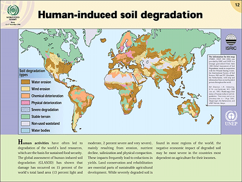
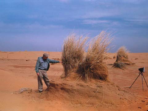
Soil is one of the most important resources on the planet – it provides us with food, fibre and fuel. When soil loses its function to grow things, it is said to be degraded. Soil degradation may take many forms such as erosion, desertification, chemical contamination or compaction.
More information on soil squishiness:
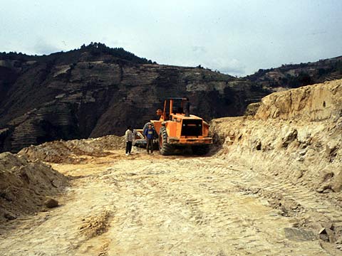
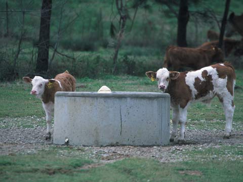
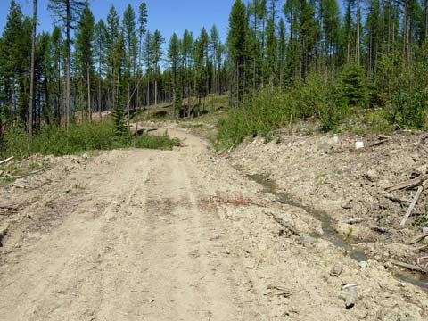
When a soil is compacted, or “squished”, the pore spaces in the soil collapse and soil becomes denser. Heavy equipment used for logging, overgrazing by livestock, or even mountain biking can all cause compaction. Once soil is compacted, roots and organisms have a hard time growing and oxygen and water levels are lower. These changes in air and water levels can also impact soil nutrient cycles. Consequently, plant growth is reduced or completely eliminated in compacted soil.
Some soil compaction is unavoidable; the challenge for land managers is to determine what level of soil compaction is acceptable. Since the degree of soil compaction depends on several soil properties including texture, organic matter, and water content, determining an acceptable level of soil compaction is not an easy task. It is particularly hard to come up with a parameter of soil compaction related to plant growth, which would be of a great value for land managers.
Examine the research summary to learn how Dr. Maja Krzic and team are trying to do just that!
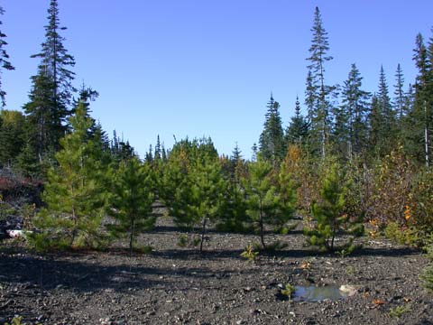
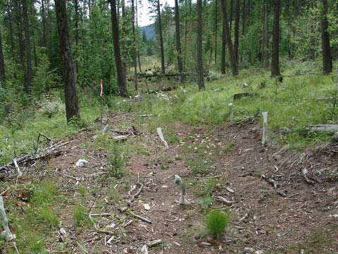
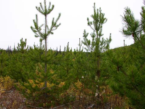
Dr. Krzic’s research team has studied forest soils throughout British Columbia to find a parameter of soil compaction that can be related to tree growth. Such a parameter would allow foresters to decide if site rehabilitation was needed to restore soil productivity. Soil rehabilitation is very expensive and time consuming, so foresters have to be able to determine whether or not it is needed on a particular site.
More information on soil squishiness:
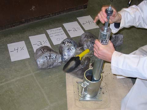
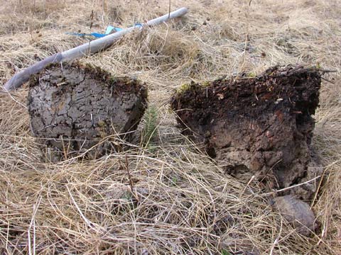
Soil bulk density (BD) is a parameter that is commonly determined by soil scientists and it is calculated as the mass of dry soil per unit volume. [To learn more about how BD is measured click here] When a soil is compacted, the soil bulk density increases. However, different soil types will have different bulk densities even if they have been compacted by the same amount of pressure because they have different soil properties, such as texture, organic matter, and water content. The team was trying to develop a parameter that could be applied to all sites, even if they have different soil properties.
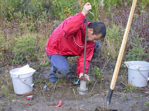
A study began in 2003 and it took 6 years, more than 400 soil samples and thousands of tree measurements to complete. Soil samples were collected and field bulk density was determined at forest sites where different logging practices had been used. For each site the soil samples were analyzed for numerous properties and the soil maximum bulk density (MBD) and relative bulk density (RBD) were calculated.
The MBD of a soil is determined by following a standard lab method (called the Proctor compaction test). [Click here to learn more about how MBD is measured] The RBD is calculated by dividing the field bulk density by MBD. The RBD determined for each soil sample was then related to growth of different tree species.
The research team showed that RBD can be used successfully to assess compaction of forest soils. In addition, we were also able to establish a relationship between the RBD and tree growth. For example, we found that rehabilitating soil at sites with a high RBD (> 0.80) would lead to good seedling establishment. This study showed that RBD can be a useful parameter for foresters in determining an acceptable level of compaction.
The research team included:
- Maja Krzic, Faculty of Forestry / Faculty of Land and Food Systems, Univ. of British Columbia, Vancouver, BC
- Yihai Zhao, Faculty of Forestry Univ. of British Columbia, Vancouver, BC (currently with SNC Lavalin, Fort St. John, BC)
- Chuck Bulmer, BC Ministry of Forests and Range, Research Branch, Vernon, BC
- Margaret Schmidt, Faculty of Environment, Simon Fraser Univ., Burnaby, BC
More Resources
As we saw in Dr. Krzic and her team’s research, measuring soil bulk density is very important and can help land managers make critical decisions!
Soil texture refers to the relative proportions of sand, silt, and clay in a soil. It is often the first and most important property to be determined when describing a soil.
Along with minerals and air, organic matter and water are important component in all soil. These can be calculated using simple techniques.
Prescribed learning outcomes (PLO) are content standards for the provincial education system; they are the prescribed curriculum. The “Maximum Soil Squishiness” research project and activities will help students to achieve the BC PLOs listed below.
PLOs are listed by code for different courses. Please consult the appropriate Integrated Resource Package (IRP) to identify the PLOs. A catalogue of the BC Curriculum Documents (including IRPs) can be found here: http://www.bced.gov.bc.ca/irp/all.php?lang=en#
- General Content
- Sustainable Resources 11 – Agriculture (A1, A3, A6); Forestry (C1, C3, C6)
- Sustainable Resources 12 – Agriculture (D4); Forestry (A3, B3, B4, C5, E4)
- Science & Technology 11 – Natural Resources and the Environment (E4)
- Geography 12 – Biomes (E2-E4); Resources and Environmental Sustainability (F2)
- Student Activities
- 1) Soil Bulk Density
- Mathematics 10 & 11 – Apprenticeship and Workplace Mathematics – Measurement
- Mathematics 11 – Apprenticeship and Workplace Mathematics – Algebra
- Science 8 – Physical Science: Fluids and Dynamics (C7)
- 2) Soil Texture
- Science 8, 9, 10 – Processes of Science (A1-A6)
- Earth Science 11 – Surface Processes and the Hydrosphere (F3)
- Geology 12 – Surface Processes and the Hydrosphere (F1, F2)
- Chemistry 11 – The Nature of Matter (B3-B5)
- 3) Soil Water & Organic Matter Content
- Science 8, 9, 10 – Processes of Science (A1-A6)
- Earth Science 11 – Surface Processes and the Hydrosphere (F3)
- Geology 12 – Surface Processes and the Hydrosphere (F1, F2)
- 1) Soil Bulk Density