Distribution of permafrost in Canada
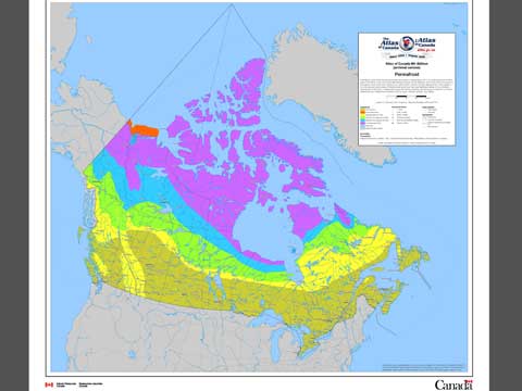
The percent values in bracket refer to the proportion of the terrestrial surface underlain by permafrost
This map has been adapted from the Government of Canada’s GeoGratis (API)
Evidence of Permafrost
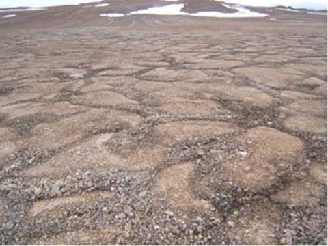
Scientists can often tell where permafrost is located without digging simply by looking at the ground surface. Unique patterns, such as this “patterned ground”, and landforms are shaped by the presence of permafrost.
Photo from Wikimedia Commons by Anthonares
Peatlands
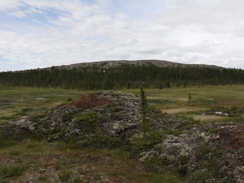
Permafrost is often found below peatlands due to the insulating effect of the thick vegetation. Palsa peatland near Whapmagoostui- Kuujjuarapik, northern Quebec
Photo by Luc Pelletier
Human Settlements
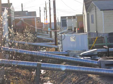
Permafrost can affect buildings and other structures due to localized thawing. These houses in Inuvik are built on stilts to prevent heat transfer into the ground. Note also that the pipes are installed above ground instead of buried below ground in the permafrost
Photo from Wikimedia Commons by Phil Morin
Human Settlements
When houses or other structures are built directly on or in permafrost, the permafrost will begin to thaw causing instability. This traditional home in Siberia was built directly on the ground
Photo from Wikimedia Commons by Adam Jones
Coring the Permafrost
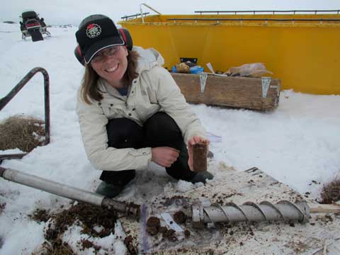
Photo of Elyn Humphreys using a gas-powered auger to sample frozen soil in Canada’s low Arctic
Photo by Peter Lafleur
Soil Sampling
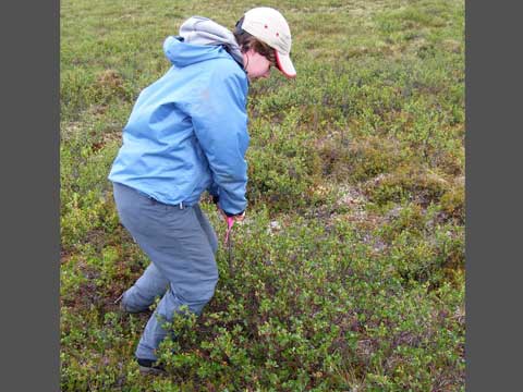
A student uses an auger to determine the depth of the permafrost
Photograph by Elyn Humphries, Carleton University
Study Site
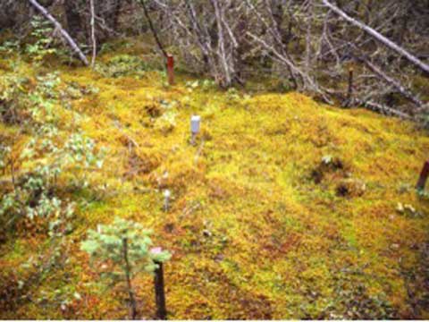
This image shows one of the undisturbed study plots. Note that the surface cover is intact
Photograph by Dr. C.R. Burn, Carleton University
Study Site
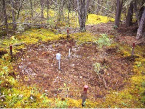
This image shows one of the disturbed study plots. Note that the surface cover has been removed from the site
Photograph by Dr. C.R. Burn, Carleton University